
Features SmartMate
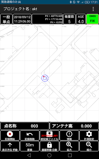
Using GNSS, it is possible to record the latitude and longitude of the current position, world geodetic system / Japan geodetic system / UTM.
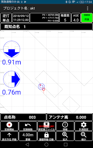
In addition, the function to display the deviation with respect to the registered point and to guide and record it (reverse strike single point),There is a function (Surveying point single point) that displays the distance to the registered line and displays guidance.The recorded data can be stored on a cloud server and displayed on a map, or output with ShapeFile, CSV, or station SIMA.(It is currently in beta.)※ In order to use all the functions of this application, ID, PW issued by our company is required.
Gaming Features
Enjoy immersive gaming experience with various game modes.
Shopping Features
Shop online and find the best deals.
Smart Home
Control and monitor your home with smart features.
See the SmartMate in Action
Get the App Today
Available for Android 8.0 and above